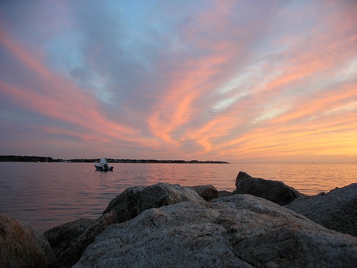
Megansett Harbor Fishing Spot
- Public Fishing: Yes
- Website: http://www.buzzardsbay.org/megans.htm
- Last Modified By: nerdyangler on 08/17/21 11:00 AM
- Ask about Megansett Harbor in our Fishing Forums
Photos
Fish Species
Comments
-
Have you fished at Megansett Harbor? Be the first to comment on this fishing spot.
Megansett Harbor Baits and Tackle
Lure (Other) Check Prices
- trolling a white unbrella rig from island to the red bouy. while trolling i threw medium size stick crank baits off the side and hooked up. i would make sure your hooks are strong we had a few straighten out and loss the fish
Jerk Bait Check Prices
Megansett Harbor Description
Megansett and Squeteague Harbors are really the outer and inner portions of a larger embayment complex. These Harbors are situated much like the Buttermilk Bay and Phinneys Harbor complexes, with a larger well flushed outer basin and a much smaller shallower more circulation restricted inner basin. In these systems the inner basin tend to receive much of the watershed nitrogen input which is then passed to the outer system in tidal flows. Fortunately for the water quality of Squeteague Harbor the source water from Megansett Harbor which has excellent water quality comparable to offshore Buzzards Bay conditions, and these waters therefore aids in diluting nitrogen inputs from the adjacent uplands and moderate conditions in Squeteague. The Megansett Harbor drainage basin is one of the larger sub-basins on Buzzards Bay's eastern shore and contains 2 public water supply wells and a large parcel of open space. These land-uses should help to preserve water quality by reducing nitrogen sources within those portions of the watershed. The embayment also has extensive eelgrass coverage. Water quality in Megansett and Squeteague Harbors was among the best of all of the embayments monitored in Buzzards Bay. Megansett Harbor, which is a mile wide at the mouth and a mile long, is situated between Scraggy Neck and Nyes Neck, with Wild Harbor to the south of Nyes Neck. The breakwater at Megansett Harbor is 3.9nm from Red Brook Harbor, 4.1nm from the breakwater at the West Falmouth Harbor entrance, and 7.0nm from Ram Island in Sippican Harbor. Overnight anchoring requires permission of the Bourne harbormaster (VHF 9). The town of Bourne has two pumpout boats that can be reached through the harbormaster. All marked inner channels and harbors are headway speed only. Powering on or off trailers at town landings is prohibited. There is a 15-minute limit to tie up at town landings and floats. From the north and northwest, the only navigational problems are Southwest Ledge, west of Scraggy Neck and marked at its perimeter by R N "2" and R N "10," and Seal Rocks, identified to the south by G C "3." Give these a berth of at least 500 yards, and do not cut inside Southwest Ledge. CAUTION: Avoid Southwest Ledge and Seal Rocks. While they are well marked, the buoys don't really identify the end of the danger zones. Also check the direction of the fast currents from the Cape Cod Canal so you don't get pushed into the rocks. The best way for newcomers to steer clear of both Southwest Ledge and Seal Rocks is to head south along Hog Island Channel to Fl R 4s R "4" in the Cleveland Ledge Channel. From here, it's a straight southeasterly shot to Fl G 4s G "1" marking the entrance to Megansett Harbor. Leave the shortcuts to this mark to the locals.
