Massachusetts Fishing Spots
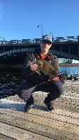
Charles River
Avg. Rating: 4.529
# Reviews: 17
Views: 37081
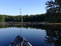
A-1/stump Pond
Avg. Rating: 4.688
# Reviews: 16
Views: 39042
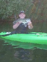
Billington Sea
Avg. Rating: 4.214
# Reviews: 14
Views: 19778
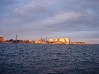
Deer Island Flats
Avg. Rating: 5
# Reviews: 8
Views: 15010
Asnacomet Pond
Avg. Rating: 4.875
# Reviews: 8
Views: 27805
Jacobs Pond
Avg. Rating: 3.455
# Reviews: 11
Views: 9027
 Dec 31, 1969
|
Lake Chaubunagungamaug
Lake Chaubunagungamaug (pronounced /t???b?n???????m???/), also known as Webster Lake, is a lake in the town of Webster, Massachusetts, United States. ... |
Map It | |
 Dec 31, 1969
|
Lake Cochichewick
Lake Cochichewick is a lake in North Andover, Massachusetts that collects water from Weir Hill and other local uplands. Its overflow drains into the C... |
Map It | |
 Dec 31, 1969
|
Lake Cochituate
This fertile, 614-acre lake is one of the most complex and heavily fished waters in Massachusetts. The lake is divided into three major basins, which ... |
Map It | |
 Dec 31, 1969
|
Lake Denison
This 85-acre lake in Winchendon averages eight feet in depth with a maximum depth of 15 feet. The shore is undeveloped because the area is part of the... |
Map It | |
 Dec 31, 1969
|
Lake Gardner
This long, narrow, 80-acre impoundment, located about a half-mile northwest of Amesbury center, has a maximum depth of 17 feet and an average depth of... |
Map It | |
 Dec 31, 1969
|
Lake Garfield
Species: Smallmouth Bass, Bullhead Catfish, White Perch, Yellow Perch, Chain Pickerel, Brook Trout, Brown Trout, Northern Pike |
Map It | |
 Dec 31, 1969
|
Lake George
Unfortuneately, Mass Wildlife has no info about Lake George posted on it's website yet other than the Depth map for which the link is located here... |
Map It | |
 Dec 31, 1969
|
Lake Holbrook
This is a pretty decent size lake with a decent variety of fish. It's in a residential area, so it's one of those over-looked spots |
Map It | |
 Dec 31, 1969
|
Lake Lashaway
Lake Lashaway is a 293-acre warm water pond located in North Brookfield north of Route 9. The water is brown in color with a transparency of ten feet.... |
Map It | |
 Dec 31, 1969
|
Lake Lorraine
Lake Lorraine is a 30-acre lake immediately south of Route 20 in a highly urbanized section of Springfield. Average depth is 17 feet and the maximum d... |
Map It |